
How Nature Became Architecture In Meghalaya
North East India has moved from being a peripheral region to appearing more consistently in global travel media and guidebooks. Publications such as Lonely Planet have featured the region for its landscapes, wildlife and cultural depth, prompting international travellers to look beyond India’s traditional circuits. At the same time, improved flight connections and gradual upgrades to roads and regional airports have made access significantly easier than it was even five years ago.
The rise in interest also reflects broader travel behaviour. As awareness of mass tourism grows, travellers are seeking destinations that feel less crowded and more landscape driven, with a stronger sense of local identity. North East India aligns with that shift, defined by dramatic terrain, distinct indigenous cultures and wildlife regions such as Kaziranga. Within this broader momentum, Meghalaya has emerged as one of the most visible and distinctive states.
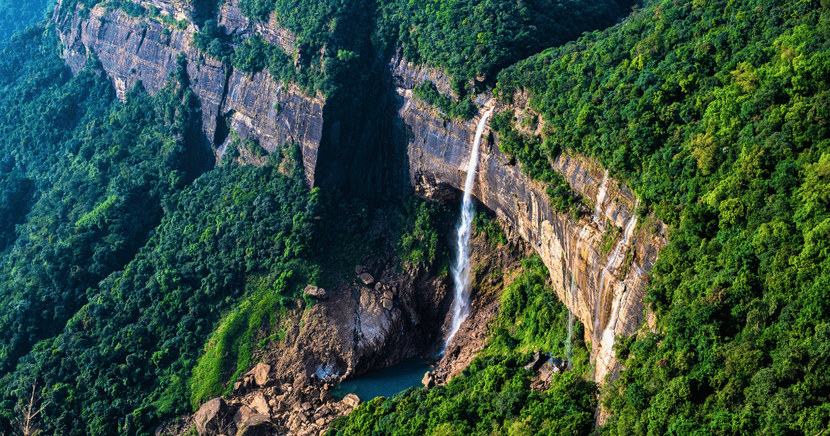
The mighty Nohkalikai Falls on the edge of the Khasi plateau in Meghalaya, a defining feature of the wild terrain of North East India.
Why is Meghalaya so different from the rest of India?
Meghalaya stands apart because its identity is shaped primarily by geology and climate rather than by dynasty or monument. While many first time visitors associate India with forts, temples and imperial architecture, the defining features of Meghalaya are limestone plateaus, deep valleys and heavy monsoon systems that have carved the terrain over centuries. Water is not seasonal here, it’s structural.
The rhythm of travel reflects this environment. Journeys move through forest corridors and ridge lines rather than between former capitals. Settlements are smaller and more dispersed, often integrated into the terrain rather than imposed upon it. Man-made structures feel modest, with timber houses and village pathways set within dense vegetation. The visual language is one of mist, stone and canopy.
Culturally, Meghalaya also operates differently from many better known regions of India. Khasi, Jaintia and Garo communities maintain distinct languages and governance systems, and in many areas inheritance follows a matrilineal structure. Daily life centres on community networks, agriculture and local trade rather than monumental sites. Together, these environmental and social systems create a region that feels self-contained and distinct.
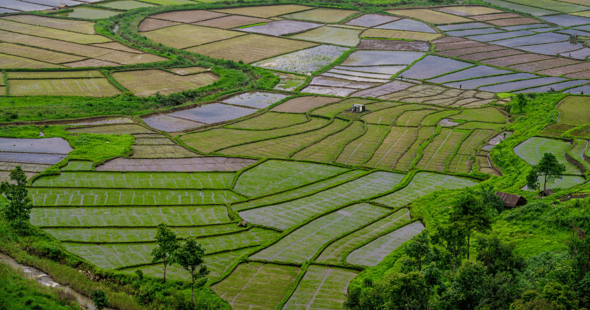
Rice cultivation in Meghalaya, an example of working with the landscape rather than against it.
What is Meghalaya known for?
Meghalaya is recognised for a combination of ecological scale and distinctive social systems that are unusual within India. Rather than being defined by monumental architecture or former royal capitals, the state is associated with living root bridges, high rainfall, limestone caves and a matrilineal cultural framework that continues to shape daily life. These elements are not isolated attractions but part of a wider environmental and community structure.
Living Root Bridges
The living root bridges are concentrated in the East Khasi Hills, particularly around Nongriat, Tyrna and the valleys below Sohra. The most visited example is the double decker root bridge in Nongriat, reached via a descent of more than 3,000 stone steps from Tyrna village. Additional bridges can be found near Mawlynnong, Pynursla and in smaller settlements where rivers cut through steep forested terrain.
These structures are formed from the aerial roots of the Ficus elastica tree. Local Khasi communities guide the young roots across temporary bamboo scaffolding, encouraging them to anchor into soil and stone on the opposite bank. Over 15 to 25 years the roots thicken and intertwine, forming stable walkways capable of supporting sustained foot traffic, including livestock and goods.
Many bridges remain in daily use rather than being preserved as heritage pieces. Their longevity reflects adaptation to Meghalaya’s heavy rainfall and frequent flooding. In an environment where timber structures decay quickly, living root bridges strengthen over time, responding directly to the region’s climate rather than resisting it.
Dramatic Waterfalls
The escarpments around Sohra, commonly known as Cherrapunji, create some of the most concentrated waterfall systems in India. Nohkalikai Falls drops more than 300 metres into a deep plunge pool and is often cited as one of the tallest in the country. Seven Sisters Falls stretches across a wide cliff face during peak monsoon, while Dainthlen Falls and Wei Sawdong Falls are regularly included on regional routes from Shillong.
The scale of these waterfalls is tied to the abrupt geological drop between the Khasi plateau and the plains of Bangladesh. During the southwest monsoon, sustained rainfall feeds dozens of streams that spill over the edge of the escarpment. In peak season, entire cliff lines can appear layered with flowing water.
Most key viewpoints are accessible by road from Shillong or Sohra, making them practical additions to a Meghalaya itinerary. While visually striking, the waterfalls also demonstrate how rainfall continues to shape erosion patterns and valley formation across the plateau.
Limestone Caves
Meghalaya contains some of the longest and most complex cave systems in India, particularly in the Jaintia Hills and parts of the East Khasi Hills. Krem Liat Prah is recognised as one of the country’s longest cave systems, extending for many kilometres, while Krem Mawmluh near Sohra holds geological significance linked to global climate studies. Mawsmai Cave, also near Sohra, is the most accessible and commonly visited.
These caves are formed as rainwater filters through porous limestone, gradually widening fractures into tunnels and chambers. Over centuries, underground rivers carve passageways while mineral rich water deposits form stalactites and stalagmites. Some cave systems require technical exploration, while others allow guided entry for visitors.
Exploring caves such as Mawsmai provides a direct understanding of how Meghalaya’s geology operates beneath the forest floor. The same rainfall that creates waterfalls above ground continues its work underground, reshaping the plateau through steady chemical and physical processes.
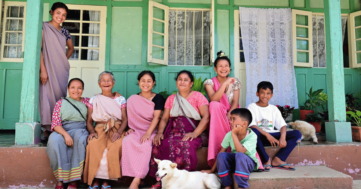
Matrilineal Culture
Among Khasi and Jaintia communities, lineage and inheritance traditionally pass through the female line. The youngest daughter, known locally as the khadduh, often inherits ancestral property and assumes responsibility for family care. This structure influences household organisation, land ownership and social continuity across generations.
In Shillong, markets such as Iewduh Bara Bazar frequently see women acting as traders and economic decision makers. While governance structures and modern employment patterns coexist with tradition, the matrilineal framework continues to shape family dynamics in visible ways.
For visitors to North East India, this is encountered through everyday life rather than formal presentation. Conversations about family names, property and lineage often reveal how the system operates. It offers a perspective on social organisation that differs from the patriarchal inheritance patterns common in much of India.
Exceptional Rainfall
Meghalaya’s reputation for rainfall is the result of its geographic position. The state sits along the southern edge of the Khasi and Jaintia plateau, directly facing moisture laden winds that move north from the Bay of Bengal. When these air masses reach the abrupt rise of the plateau, they are forced upward, cool quickly and release heavy precipitation.
This process is known as orographic rainfall, and it explains why locations such as Mawsynram and Sohra record some of the highest annual rainfall totals in the world. The escarpment acts as a barrier, concentrating rainfall along its edge before the air continues inland with far less moisture.
The impact of this sustained rainfall is structural. It drives erosion, carves valleys, feeds rivers and supports dense subtropical forest. It also accelerates the formation of limestone caves beneath the surface. In Meghalaya, rainfall is not simply frequent. It is central to how the landscape has developed.
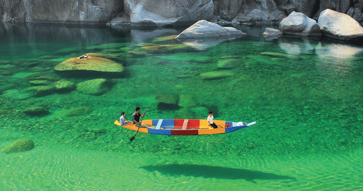
The Umngot River near the Bangladesh border in Dawki, one of Meghalaya’s most recognisable natural wonders.
When is the best time to visit Meghalaya?
The most comfortable time to visit Meghalaya and the wider North East India region is generally from October to April. During these months, rainfall reduces significantly, skies are clearer and road conditions are more reliable. Waterfalls continue to flow, though at lower volume than peak monsoon, and visibility from viewpoints around Sohra and Laitlum Canyon is typically better.
Winter, particularly December to February, brings cooler temperatures, especially in Shillong and higher altitude areas. Daytime conditions are usually mild, while evenings can be noticeably cold. This period suits travellers interested in trekking, village walks and cave visits without the challenges of heavy rain.
The monsoon months bring a very different atmosphere. Rainfall intensifies waterfalls and deepens the region’s green landscape, but access can be slower and visibility more limited. For travellers comfortable with wet conditions and shifting weather, the monsoon offers dramatic scenery. For ease of movement and broader access, the drier months remain the more practical choice.
Do you need a permit to visit Meghalaya?
No special permit is required for foreign travellers visiting Meghalaya. With a valid Indian tourist visa, visitors can travel freely to Shillong, Sohra, Nongriat, Dawki and other main destinations within the state.
This differs from some neighbouring states in North East India, such as Arunachal Pradesh, Nagaland and Mizoram, where foreign nationals require a Protected Area Permit. Meghalaya does not fall under that category, and there are no additional entry restrictions for standard tourism routes.
Travellers should still carry passport identification and visa documentation, particularly when staying in registered accommodation or travelling near the international border with Bangladesh. However, for typical sightseeing and trekking within Meghalaya, no additional permits are needed.
While certain states in North East India restrict entry to safeguard tribal land and culture, Meghalaya is open to foreign travellers.
Discover the best of North East India with India Unbound
Established in 2007, India Unbound is an award-winning travel company specialising in custom-made journeys and private tours of India. With more than two decades of experience, we create unique itineraries for Australian travellers looking for their next big adventure.
If you’re considering adding Meghalaya or a wider North East India tour to your journey, we can design a route that combines Shillong, Sohra, Kaziranga and lesser-known hill regions with seamless logistics and private guiding throughout. Get in touch to discuss building your ideal tailor-made journey in North East India.